Your expensive gear is useless if you don’t understand the unique environmental traps of UAE mountains.
- The biggest dangers are not gear-related but environmental: flash floods, thermal inertia, and critical miscalculations.
- Safety comes from a mindset shift, not a longer packing list. It requires respecting the terrain’s specific rules.
Recommendation: Before any hike, spend more time studying the specific risks of your chosen trail—water sources, terrain exposure, and weather patterns up to 30km away—than you do packing your bag.
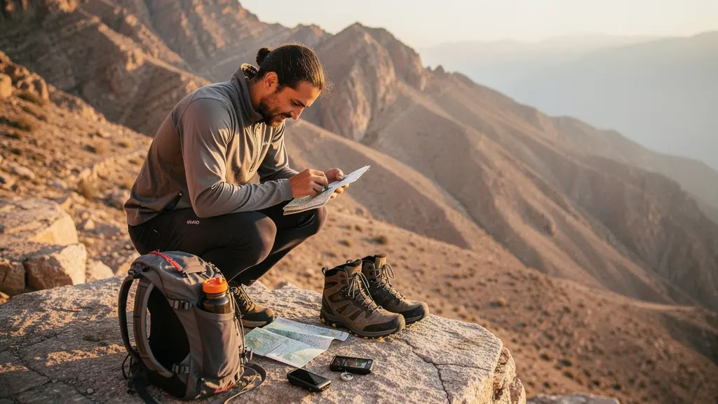
You’ve seen the incredible photos from Jebel Jais and Wadi Shawka. You’ve bought the boots, the backpack, and the hydration bladder. You feel prepared. But as a mountain rescue volunteer, I can tell you that most incidents we respond to don’t happen because of faulty gear. They happen because of a fundamental misunderstanding of the terrain. Hikers arrive expecting a simple desert landscape and are confronted with rugged, unforgiving mountains governed by rules they don’t know.
Many guides will give you a generic checklist: bring water, wear a hat, use sunscreen. While true, this advice dangerously oversimplifies the reality. It creates a false sense of security. The truth is, the UAE’s mountains are full of specific environmental traps that catch even experienced hikers off guard. This isn’t about having the most expensive equipment; it’s about adopting a survival mindset tailored to this unique environment.
This guide isn’t another packing list. It’s a strategic briefing. We will dismantle the most common and dangerous misconceptions about hiking in the UAE. We’ll explore the real risks, from flash floods born miles away to the deceptive heat of a September afternoon. You will learn to see the mountains not as a backdrop for a photo, but as a dynamic environment that demands respect, knowledge, and humility.
This article provides a critical overview of the unique challenges and necessary preparations for hiking in the UAE’s mountains. The following sections break down the most common points of failure and provide expert guidance to ensure your adventure is both thrilling and safe.
Summary: Mastering the UAE’s Deceptive Trails
- Why Are Flash Floods the Biggest Risk in UAE Wadis During Winter?
- How to Use Wikiloc to Navigate UAE Trails Without Getting Lost?
- Stairway to Heaven or Wadi Shawka: Which Trail Matches Your Experience?
- The Water Calculation Mistake That Leads to Heat Exhaustion on Trails
- Night Hiking: When Is It Safe to Hike in Summer to Avoid the Sun?
- The Driving Error That Overheats Brakes on the Way Down from Jebel Jais
- Why Is Hiking in September Still dangerous Despite Lower Temperatures?
- Why Ras Al Khaimah Is Becoming the Top Adventure Hub in the Middle East?
Why Are Flash Floods the Biggest Risk in UAE Wadis During Winter?
The most dangerous environmental trap in the UAE mountains isn’t the heat; it’s the water. During winter, a clear, sunny day in a wadi (a dry riverbed) can turn deadly in minutes. This is because a storm 20-30 kilometers upstream can send a wall of water rushing down the canyon with no local warning. These areas can receive up to 350 mm of rainfall annually, and the hard, baked ground creates rapid, violent runoff. For instance, in the December 2025 storms, some areas of Ras Al Khaimah received 127mm of rain in just two days, causing widespread flooding.
These wadis are natural funnels. The water, thick with mud and debris, moves with the force of a freight train, scouring everything in its path. Believing you can outrun or climb away from a flash flood is a fatal mistake. The only way to survive is to never be in its path in the first place. This requires active vigilance, not just a quick glance at the sky above you. Your survival depends on spotting the early warning signs that a flood is coming, long before you can see the water itself.
You must become a student of the environment. Before entering any wadi, check the forecast not just for your location, but for the entire surrounding mountain range. Be aware of these critical early indicators:
- A sudden change in water color to murky brown, even if it’s just a trickle.
- A distant rumbling sound that doesn’t sound like thunder.
- Small twigs, leaves, and other debris suddenly beginning to flow in what was dry ground.
- Local wildlife, like birds or goats, suddenly moving to higher ground.
If you observe any of these signs, do not hesitate. Immediately abandon your hike, get to the highest possible ground, and wait. Do not attempt to cross flowing water, no matter how shallow it appears.
How to Use Wikiloc to Navigate UAE Trails Without Getting Lost?
In the maze of unmarked goat paths and intersecting canyons that define many UAE trails, a GPS app like Wikiloc is no longer a luxury; it’s an essential piece of safety equipment. It allows you to follow a pre-defined track and see your position in real-time, preventing the simple mistake of taking a wrong turn, which can have cascading, dangerous consequences. Getting lost wastes precious energy and water and can lead you into treacherous, inescapable terrain.

However, relying on technology without understanding its limitations is another common environmental trap. Phone batteries die, mobile signals disappear in deep wadis, and screens can be unreadable in the harsh sun. Your phone is a tool, not a savior. The key is to build a system of digital-to-analog redundancy. This means you use the technology as your primary guide but have robust, non-digital backups ready for the moment it fails. Your life cannot depend on a single, fragile piece of electronics.
Before you even leave your car, you must have a clear protocol for potential digital failure. This is not optional. It is a mandatory part of your pre-hike safety check. Follow these steps without exception:
- Download your trail map for offline use while you still have a strong WiFi connection.
- Take screenshots of critical junctions, elevation profiles, and the overall map as a visual backup.
- Enable airplane mode on your phone once you start navigating to preserve the battery.
- Carry a fully charged power bank and the correct cable. A dead phone with a downloaded map is just a useless piece of glass.
- As an extra layer, consider downloading the trail on a secondary offline map app, like Organic Maps, as a complete redundancy.
Think of your digital navigation not as a guarantee, but as one layer in a multi-layered safety system. The moment it fails, you should already have your backup plan in motion.
Stairway to Heaven or Wadi Shawka: Which Trail Matches Your Experience?
One of the most frequent causes of rescues is a mismatch between a hiker’s ability and the trail’s difficulty. A trail’s length in kilometers is a poor indicator of its true challenge. The UAE’s terrain is characterized by steep elevation changes, loose scree, and high levels of exposure (proximity to a dangerous fall). A 4km trail like “Stairway to Heaven” is vastly more dangerous and demanding than a 10km walk like the Wadi Shawka loop because it involves vertical scrambling on exposed cliff edges. Choosing a trail based on Instagram photos without an honest self-assessment of your fitness and technical skill is a gamble.
You must be brutally honest with yourself. “Intermediate” fitness in a gym does not translate to “intermediate” on a mountain. Local guides often use a more nuanced classification system. For example, a trail like Jebel Yabnah is rated “intermediate+”—meaning it’s only for highly fit hikers capable of trekking for up to 10 hours with significant elevation gain. If your experience is limited to flat paths, attempting a trail with this rating is irresponsible.
To help you make a more informed choice, here is a comparison of three popular trails, illustrating how different factors contribute to their overall difficulty. As this table from data compiled on AllTrails shows, distance is only one part of the story.
| Trail | Distance | Elevation Gain | Technical Skill | Exposure Level | Fitness Required |
|---|---|---|---|---|---|
| Wadi Shawka Loop | 10 km | 300m | Low (marked path) | Minimal | Moderate |
| Wadi Naqab | 8 km | 600m | Intermediate (steep stairs) | Moderate | High |
| Stairway to Heaven | 4 km | 450m | Advanced (scrambling) | Very High | High |
Before you choose a trail, research it beyond its popularity. Look for terms like “scrambling,” “exposure,” “bouldering,” and “unmarked.” If you don’t know what these mean, you are not ready for that trail. Start with well-marked, low-elevation trails and progressively build your experience and confidence. The mountains will be there next year; make sure you are too.
The Water Calculation Mistake That Leads to Heat Exhaustion on Trails
The most common piece of advice for desert hiking is “bring lots of water.” This is dangerously vague. Running out of water is not an inconvenience; it is the first step toward heat exhaustion, heatstroke, and a medical emergency. The critical mistake hikers make is underestimating their consumption rate and failing to build in a safety buffer. In the hot, dry air of the UAE, you lose moisture not just through sweat but also through every breath you exhale.

The baseline for planning is to plan for about 1 liter of water per hour of hiking in hot desert conditions. This is a starting point, not a fixed rule. A full-day hike can easily require 6-8 liters per person. Your personal calculation must be more dynamic, taking into account your body weight, the intensity of the hike, and the temperature. You must also replace the salts and electrolytes lost through sweat, not just the water. Pack electrolyte tablets or powders to add to your water.
Developing a rigorous hydration discipline is non-negotiable. This means moving from guessing to calculating. Before every hike, you should conduct a quick audit to ensure you are not just carrying water, but carrying the *right amount* of water for the specific conditions of the day.
Your Pre-Hike Hydration Audit
- Baseline Calculation: Start with a base of 0.5 to 1 liter per hour of planned hiking time. Always round up.
- Intensity Factor: Add an extra 0.5 liter per hour for trails with significant elevation gain (more than 150m per hour).
- Temperature Check: For every 5°C the forecast is above 30°C, add an additional 0.5 liter to your total.
- Emergency Buffer: After all calculations, add one full, untouched liter of water as your emergency reserve. This water is not for drinking on the hike; it’s for survival if something goes wrong.
- Electrolyte Check: Confirm you have at least one serving of electrolytes for every liter of water you plan to drink after the first hour.
Remember, the goal is to end the hike with your emergency liter untouched. If you are consistently finishing your hikes with no water left, your calculations are wrong, and you are operating without a safety net.
Night Hiking: When Is It Safe to Hike in Summer to Avoid the Sun?
To escape the brutal daytime heat of a UAE summer, many hikers turn to night hiking. The logic seems sound: no sun means cooler temperatures. This is a dangerous oversimplification. While you avoid the direct solar radiation, the environment itself remains a formidable challenge. Summer nights are not cool; they are merely less scorching. According to recent analysis, even at night, UAE summer temperatures can range from 32°C to 37.2°C. Hiking in these conditions is still extremely strenuous and carries a high risk of heat-related illness.
Furthermore, darkness introduces a new set of risks. Your field of vision is reduced to the beam of your headlamp. This makes spotting trip hazards, loose rocks, and the trail itself significantly harder. It also hides the presence of nocturnal wildlife, like snakes and scorpions, which are more active after sunset. A simple sprained ankle, manageable in daylight, becomes a serious emergency in the dark, miles from help.
Safe night hiking is only possible with specific equipment and a strict protocol. It is not something to be attempted casually. Your standard day hiking gear is inadequate. You must plan for equipment failure and the unique challenges of navigating in the dark.
- Carry a primary headlamp with a minimum output of 300 lumens, and ensure it has fresh batteries.
- Pack a backup headlamp. Not just backup batteries, but a completely separate, functional headlamp.
- Use trekking poles. They help you maintain balance and can be used to probe the path ahead for unseen obstacles or creatures.
- Know your route intimately. You should only attempt night hikes on trails you have completed multiple times in daylight.
- Inform someone of your exact route and your expected return time. This is non-negotiable.
- Check the moon phase. A full moon can provide significant ambient light, while a new moon will plunge the landscape into total darkness, making navigation far more challenging.
In my opinion, hiking during the peak summer months (June to August), even at night, carries an unacceptably high risk for all but the most experienced and prepared desert trekkers. The safer alternative is to wait for the cooler months.
The Driving Error That Overheats Brakes on the Way Down from Jebel Jais
Your safety responsibilities don’t end when you get back to the car. The drive to and from the trail is part of the adventure, and it has its own unique risks, especially when descending from high-altitude trailheads like those on Jebel Jais. At 1,934 meters, the UAE’s highest peak, the long, winding descent puts immense and continuous strain on your vehicle’s braking system.
The most common and dangerous driving error is “riding the brakes”—maintaining constant pressure on the brake pedal for the entire descent. This generates an incredible amount of heat, which can lead to “brake fade.” This is a terrifying situation where your brake fluid boils, and your brake pedal goes soft or straight to the floor, leaving you with little to no stopping power on a steep mountain road. We see this happen every season, and the consequences can be catastrophic.
The correct technique is to let your engine do the work. This is called engine braking. By shifting your car (even an automatic) into a lower gear, you use the engine’s compression to slow the vehicle, saving your brakes for when you actually need to stop. This technique is not optional; it is the only safe way to navigate a long, steep descent.
Even if you have an automatic transmission, you can and must use engine braking. Here is the protocol:
- Before you begin the descent, shift your automatic transmission into Manual mode (‘M’), or a low gear like ‘L’, ‘2’, or ‘3’.
- Select a gear that keeps your speed under control without you needing to touch the brakes. The engine will sound loud; this is normal.
– Use the accelerator to maintain speed, and only use the brake pedal for short, firm applications to slow down for sharp corners. – Make use of the designated pull-over areas every 10-15 minutes to let your brakes cool down. You can often smell them if they are overheating. – Always monitor your car’s temperature gauge during the descent.
Treat the drive with the same respect you give the trail. Your adventure is only successful once you are home safely.
Why Is Hiking in September Still dangerous Despite Lower Temperatures?
By September, the official peak of summer has passed. The news reports slightly lower air temperatures, and hikers, eager to return to the trails, can be lulled into a false sense of security. This makes September one of the most dangerous months. The mistake is confusing a drop in air temperature with a safe hiking environment. The real danger is not in the air, but in the ground beneath your feet.
The concept you must understand is thermal inertia. For months, the rock and sand of the mountains have been absorbing and storing the intense heat of the summer sun. They are like a giant storage heater. Even when the air temperature drops to 38°C, the ground you are walking on, sitting on, and touching is still radiating heat well over 50°C. This radiant heat cooks you from below, dramatically increasing your body temperature, dehydration rate, and risk of heatstroke.
This retained ground heat makes any fall or need to rest on the ground particularly hazardous. It also means the air just above the trail surface is significantly hotter than the officially reported temperature, which is measured several feet above the ground in the shade. You are effectively walking through a thermal oven.
Furthermore, humidity levels can often be higher in September. High humidity makes it much harder for your body to cool itself through sweating because your sweat doesn’t evaporate as quickly. The combination of high humidity and high radiant ground heat creates a uniquely dangerous environment where heat-related illnesses can develop with shocking speed. From a rescue perspective, we often see a spike in calls during this transitional month because people are misjudging these invisible forces.
Do not be the first one back on the trail. Resist the temptation until ambient daytime temperatures are consistently below 30°C, typically by mid-to-late October. Let the mountains have a chance to cool down properly. Your patience will be rewarded with a much safer and more enjoyable hiking season.
Key Takeaways
- Respect the Environment, Not Just Your Gear: The most significant threats—flash floods, thermal inertia, and extreme heat—cannot be defeated by expensive equipment, only by knowledge and avoidance.
- Plan for Failure: Your navigation and hydration strategies must include redundancy. Assume your primary systems will fail and have a backup plan ready.
- Honest Self-Assessment is Paramount: Choosing a trail that exceeds your true fitness and skill level is the most common path to needing a rescue. Start small and build experience.
Why Ras Al Khaimah Is Becoming the Top Adventure Hub in the Middle East?
The emirate of Ras Al Khaimah (RAK) stands as a powerful example of how to develop adventure tourism responsibly. Its rise as a premier hiking destination isn’t an accident; it’s the result of a deliberate strategy that combines stunning natural assets with a deep commitment to safety, accessibility, and infrastructure. By embracing its mountainous terrain, RAK provides a blueprint for what a mature and safe outdoor adventure culture looks like.
A key factor in this success has been the formal development of safe, marked trails. Trail designers like Fadi Hachicho have meticulously mapped and created over 100 kilometers of official hiking trails that cater to a wide spectrum of abilities, from beginners to seasoned trekkers. This proactive approach helps mitigate the risk of hikers getting lost on dangerous, unofficial paths. Furthermore, RAK has attracted world-class adventure events like the Highlander UAE, a multi-day backcountry challenge that puts the region’s trails on the international stage and promotes a high standard of trekking preparedness.
RAK’s success teaches us a valuable lesson that brings us back to the core message of this guide. The emirate thrives not by ignoring the dangers of its mountains, but by understanding, respecting, and managing them. They provide clear information, marked routes, and support infrastructure, empowering hikers to make safer choices. This is the same mindset you must adopt for your personal safety. You are the manager of your own expedition. Your success depends on your ability to gather intelligence, understand the risks, and make conservative, safety-oriented decisions.
Ultimately, becoming a better, safer hiker isn’t about accumulating gear. It’s about accumulating knowledge and a deep, abiding respect for the power of the mountains. Every trail, every weather forecast, every liter of water you calculate is a chance to practice this mindset. This is how you ensure that you not only survive your adventures but can continue to enjoy them for years to come.
Your next step is not to buy a new piece of gear. It is to sit down with a map of the trail you want to hike, study its topography, research recent trip reports, and honestly assess if your current ability matches its demands. This preparation is the most important part of your journey.